<img src="/images/world-continents.png" width="320" height="160" orgwidth="320" orgheight="160" usemap="#world-continents">
<map name="world-continents">
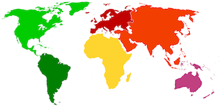
  <area title="North America" href="https://en.wikipedia.org/wiki/North_America" shape="poly" coords="48,89,67,69,77,49,140,0,68,0,6,10,4,31,16,69">
  <area title="South America" href="https://en.wikipedia.org/wiki/South_America" shape="poly" coords="48,88,61,74,119,99,95,160,66,159">
  <area title="Europe" href="https://en.wikipedia.org/wiki/Europe" shape="poly" coords="124,49,145,46,158,50,187,43,198,6,146,1,115,21">
  <area title="Africa" href="https://en.wikipedia.org/wiki/Africa" shape="poly" coords="121,53,140,47,169,51,186,77,196,80,188,137,156,136,138,97,118,86">
  <area title="Asia" href="https://en.wikipedia.org/wiki/Asia" shape="poly" coords="166,50,184,77,201,74,215,91,258,108,263,87,283,74,297,8,192,3,191,29,187,46,170,42">
  <area title="Australia" href="https://en.wikipedia.org/wiki/Australia_(continent)" shape="poly" coords="257,107,263,85,314,89,316,137,294,151,249,132,248,114">
</map>
